地 図
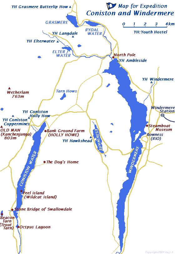
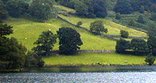
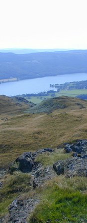
私が歩き回るときにほしかった地図を描いてみました。コニストン湖とウインダミア湖周辺の探検のための地図です。
"The only way to keep a secret (your own and other people's) is NEVER to answer a question. But you seem good at guessing. All the places in the books are to be found, but not arranged quite as in the ordnance maps. You seem to be just the those books. I am glad you like them."
With best wishes from
Arthur Ransome
Roger Wardale著「in the search of SWALLOWS & AMAZONS」より
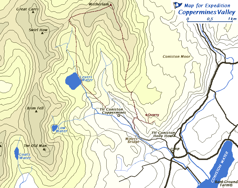
Fell は 丘、山、高地。 Moor は ヒースでおおわれた原野と辞書には書かれてます。
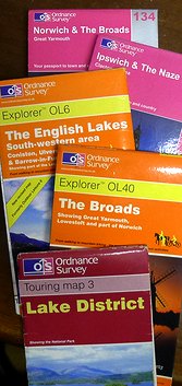
Ordnance Survey Map
探検に使う2万5000分の1の地形図は湖水地方やロンドンの書店で購入しました。
7ポンドは少し高価に思いますが、とてもしっかり書かれた地図です。日本のように道があれば野山はどこでも歩き回れるのと違って、パブリックフットパスと書かれてないと 道があっても私有地は通れません。地図にはこの区別が分かるように描かれています。
●
1:25000 湖水地方 コニストン湖など £6.99Ordnance Survey Explorer OL6 The English Lakes South-western area
●
1:25000 湖水地方 ウインダミア湖など £6.99Ordnance Survey Explorer OL7 The English Lakes South-east area
●
1:25000 ノーフォーク湖沼地方 £6.99Ordnance Survey Explorer OL40 The Broads
●
1:50000 ひみつの海 WALTON_ON_THE_NAZE £5.99Ordnance Survey LandrangerMap169 Ipswich & The Naze
これらの地図の出版はOrdnanceSurveyです。
ここは日本の国土地理院にあたるイギリスの陸地測量部です。