| Works | Biography | Blog | Contact |
|---|
   |
||
|---|---|---|
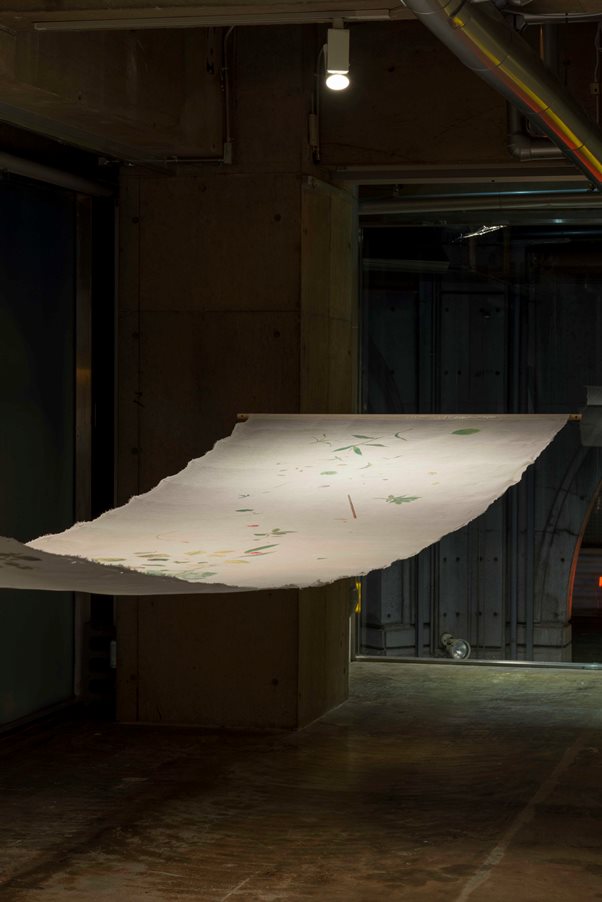
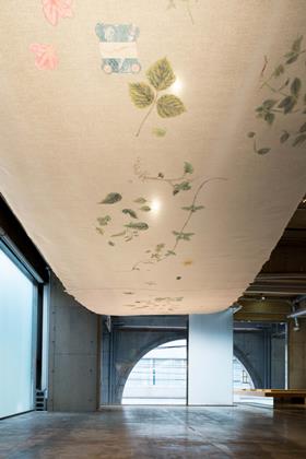
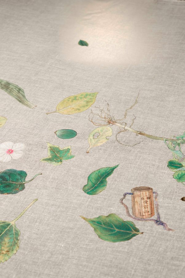
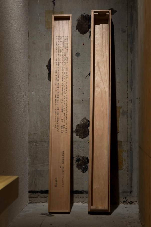
《洛西用水図》 |
Hydrographic Map of Rakusai |
|
綿布着色、桐箱 |
Ink, colors on lawn / A paulownia box |
|
個展「図譜」より(ギャラリーPARC/京都) |
Solo exhibition “Biographies” (Gallery PARC, Kyoto, Japan) |
|
2015年 |
2015 |
|
| 水路に流れてくるものを拾い、日記のように描いた。絵の裏側には、暦や日々の雑事を記した。附図として、水路の概況を地図で表し、桐箱の裏書には由来を記した。考現学的でありながら、地政学や歴史の側面、現代の社会インフラとしての機能や役割をもみることができる。 | I picked up things which were flowing in the irragation channel and drew them. To add some extra explanation, I attached a map of the area of the channel. On the backside of the cover of a storage box(Kiribako), I wrote the history of the channel. In the same spirite as modernology, People can feel the geopolitics, history and social infrastructure surrounding the channel. | |
撮影:守屋知樹 |
||
 |
|
|---|---|
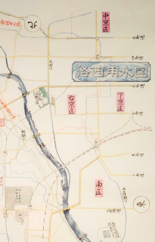
「洛西用水図 附図」 |
|
まくり;紙本淡彩 |
|
自宅前の水路の歴史や概況の調査を行い、現在の地図を記した。作成にあたり、京都市役所建設局西京土木事務所の協力を得た。 |
|
The attached map to “the Hydrographic Map of Rakusai” |
|
Ink, colors on paper |
|
| I went over the irragation channel and study the history of that thoroughly before drawing the map of the channel. And I got the cooperation of The Engineering Office of Kyoto City. |
|
 |
|
「洛西用水図 箱書」 |
|
I noted the background of the channel of Rakusai on the boxes containing the artwork. |
|
(箱書全文) |
|
|
漂流物拾得期間 自平成二十七年五月一日 |
|
至平成二十七年六月三十日 |
|
中尾 美園 |
|